
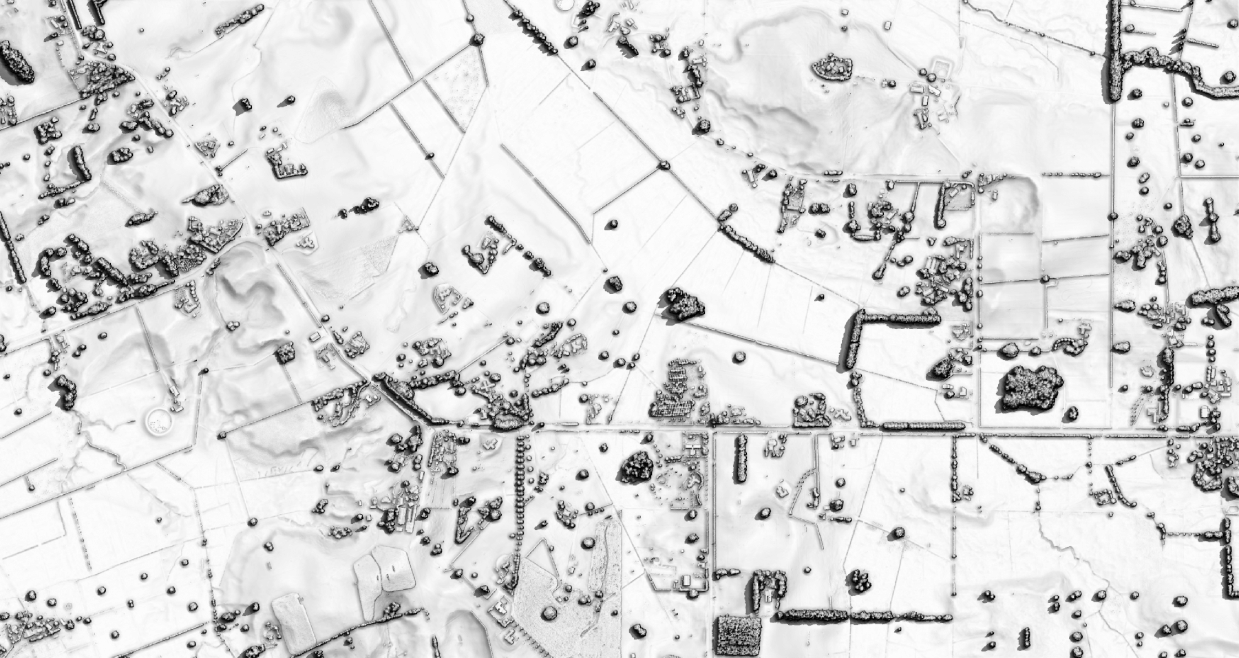
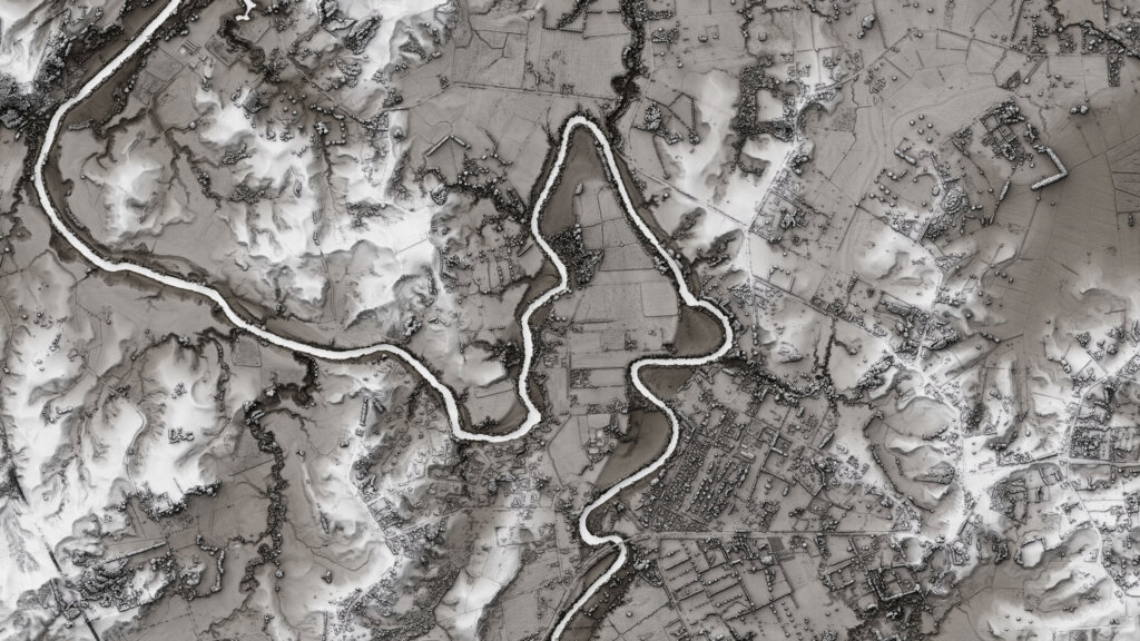
An example of a map produced with the new technology showing Koromatua Rd, with Koromatua School at the right of the image, with Jury Rd intersection toward the left edge. It can be colourised.
Waipā farmers finally have a free solution to complete an accurate and approved farm environment plan which shows their farm terrain down to the nearest metre.
Three-dimensional mapping data known as LiDar (Light Detection and Ranging) can create exact maps of the entire Waikato region.
The $2.8m LiDar project was developed with help from the Provincial Growth Fund and other partners.
It will help Waikato Regional Council accurately model natural hazards and climate change, design better infrastructure, support better land use planning and improve environmental outcomes.
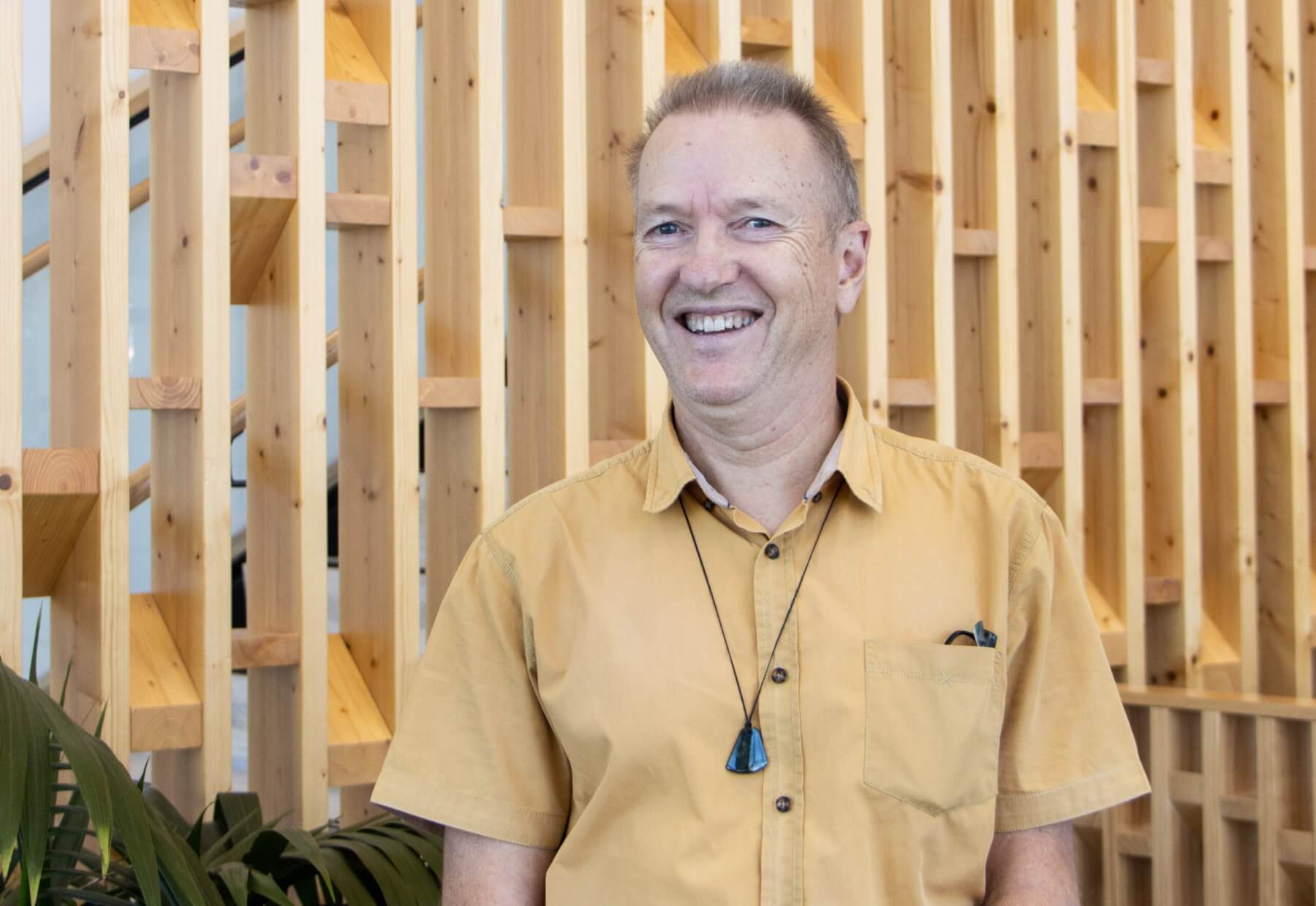
Bryan Clements
Project technical lead Bryan Clements said until now the regional council and farmers could not get anything terrain related at property scale.
“Traditionally our local government has only had the mapping layers for rivers and streams from the national topographical map series at a scale of 1:50,000.”
Farm environment plans identify environmental risks and set out ways to manage them. The plans aim to improve water quality in the Waikato and Waipā rivers by bringing in several environmental requirements for farmers within the catchments.
They require a “whole lot” of detailed map information, said Clements.
But that has often been too expensive, too hard and not pragmatic.
Thanks to the success of the LiDar project, the council could give something back to farmers so they can include the information in their plans.
“We can say ‘here’s something for free’ so hopefully that helps.”
He gave the example of waterways.
“Whereas before we’d overlay those 1:50,000 map layers over the top of aerial photography, if you zoom away at sub catchment level, it looks okay but the moment you zoom into a farm scale, clearly those water courses are very generalised and don’t sit over the aerial photography at all accurately; now they will.”
Rivers, streams, seasonal waterways, channels, wetlands, ponds and marshes can be seen at farm scale.
“Farmers will already know where their local streams are, but they won’t be able to map them. They don’t have the resources to put them on a map for their plan. We can compile that stuff and make it freely available for their consultants or whoever.”
The maps can identify where there are bush plots, fence lines and riparian planting.
“One of the requirements in plans are they must accurately show how they are mitigating soil loss off marginal terrain. Again, they are very unlikely to have been able to map that previously. We’ll give them those maps.”
The maps also show soil types and plot existing resource consents.
“All of this compilation of information is going to help.”
Clements said the project was not available to be shown at places like Fieldays yet.
-
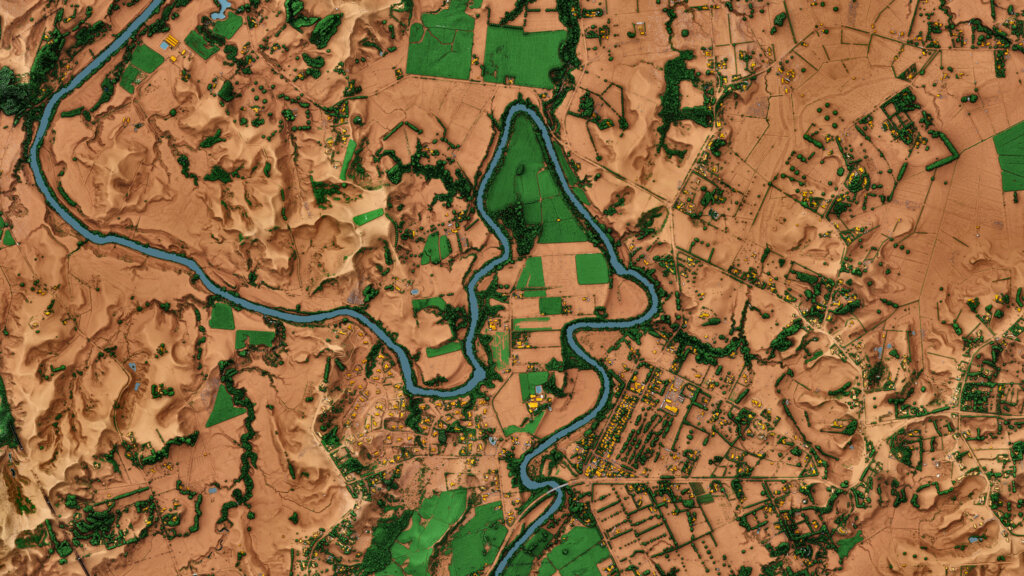
- The brown Waipā image visualisation is a Digital Surface Model, colourised to show elevation – low lying areas are darker brown and higher elevated areas are white. The image purpose is to show the lie of the land, in particular the detail/information you can glean from LiDAR data.
-
- The image shows the Waipā River, and the township of Whatawhata on its eastern banks.
“But I hope the network of consultants out there will see there is rich information available to them.
“We are excited by the opportunities this provides for our core business. But it will not only help us.
“Think coastal care groups, gully restorations, community environmental initiatives, education and research, or farm planners.”
It had been used in the Coromandel on the kauri dieback project and post Cyclone Gabrielle, there had been requests for landslip analysis.
The Provincial Growth Fund has worked with other regions to generate high-definition 3D maps and models.
Through CoLab, an organisation owned by Waikato local authorities to procure shared services, the councils joined other co-funding partners on the project including Lincoln Agritech, WEL Networks, Waikato River Authority, Mercury Energy, Toka Tū Ake EQC and Environmental Research Institute at the University of Waikato.
The first set of the Waikato data is on Toitū Te Whenua Land Information New Zealand’s Data Service. Remaining data for the region will be released progressively over the next few months.